08/11/2012. 7:10 AM.
Honeycutt Creek Start: GPS
N 35, 54.216, W 78, 37.362
Honeycutt Creek End: GPS
N 35, 54.066, W 78, 37.606
Baileywick Trail Start: GPS
N 35, 54.138, W 78, 40.172
Baileywick Trail End: GPS
N 35, 54.608, W 78, 40.099
This report features two independent trails that are both fairly short. The
Honeycutt Creek Trail is only 0.36 miles in length, and passes along the edge of
Honeycutt Park. The
Baileywick Trail is 0.6 miles in length and passes through
Baileywick Road Park. Each trail seemed a bit short for a full outing, so I decided to combine them into a single day. However, because they are several miles apart, I separately recorded all species seen on each of the trails. This means that a species first seen on the Honeycutt Creek Trail may be repeated if also seen on the Baileywick Trail.
The Honeycutt Creek trail can be easily accessed from Honeycutt Park, which is located on Clear Creek Farm Drive just west of Honeycutt Road in northeast Raleigh. The trailhead is a short walk down Clear Creek Farm Drive from the parking lot, but it is also possible to access the trail by walking through the park past the athletic field. I actually saw more birds flying around the grounds of the park on my way to and from the trail than I did along the trail itself.
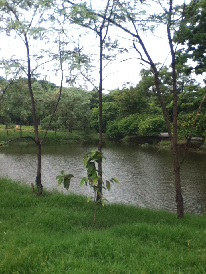
This trail is a little odd. It is apparently in planning for expansion, but at present is rather uninspiring. I would divide it into three short segments. The first runs from the trailhead to the eastern edge of the athletic field. This section has tall trees on both sides, but parallels Honeycutt road, so there is significant traffic noise. The second segment begins on the east side of the athletic field (see photo above). Here, there is a screen of trees on one side, and open grass and the athletic field on the other. The mixed habitat should attract different types of birds, although I saw relatively few species among the trees.

After skirting the park, the trail again enters the woods for a short distance, coming to an abrupt end under a set of large power lines (see photo at left). The end of this trail is only a short distance north of I-540, and there is considerable traffic noise here. Based on my experience, I'd recommend focusing on the park rather than the trail, although I did see one new species for the Capital Area Greenway list on the trail.
Birds Sighted Along the Honeycutt Creek Trail:
Summer Tanager: GPS N 35, 54.196, W 78, 37.367. A male started calling soon after I stepped onto the trail, and then seemed to follow me for a short distance along the wooded segment near the trailhead. This is a new species for the Greenway list.
Northern Mockingbird: GPS N 35, 54.170, W 78, 37.473.
Mourning Dove: GPS N 25, 54.089, W 78, 37.511. Resting on one of the large power lines.
Birds Sighted In Honeycutt Park:
Indigo Bunting: GPS N 35, 54.222, W 78, 37.503. A pair of these were resting together on the cyclone fencing in the park. I thought I saw one of these last week, but this was the first confirmed sighting and so it is a new bird for the Raleigh Greenway list.
Carolina Wren: GPS N 35, 54.239, W 78, 37.489.
House Finch: GPS N 35, 54.221, W78, 37.473. A small flock of perhaps 10 - 12 birds.
Northern Cardinal: In same area as finches.
Chipping Sparrow: A medium-size flock of perhaps 20 birds.
Ruby Throated Hummingbird: Around the bushes in the parking lot.
Baileywick Trail: I attempted to access this trail from its southern terminus on Strickland Road. There is no place to park on Strickland, and the nearest side streets are mostly quite narrow. In the end, I parked on Windjammer St. in the Wentworth Park housing development. However, after walking the trail, I would recommend either Davishire Dr. or the main parking lot for Baileywick Road Park as better places to leave a car.
I arrived at the southern entrance to Baileywick Trail at 8:40 AM, about 20 minutes after leaving Honeycutt Park. Much of this trail has trees on both sides, and many of them are pines. However, as the trail passes through the park, it also opens up onto large grassy areas, potentially attracting birds who prefer open spaces as well. In addition to the paved trail through the park, there is also an unpaved trail that runs to the west of the main route.
Birds Sighted Along Paved Part of Baileywick Trail:
American Crow: GPS N 35, 54.192, W 78, 40.177. I initially saw three of these on the roof of one of the houses along Davishire Dr.
Carolina Wren: GPS N 35, 54.223, W 78, 40.174.
Mourning Dove: GPS N 35, 54.343, W 78, 40.170.
Probable
American Goldfinch: Only got a brief glimpse of this one up high in a tree, so could not be sure.
Northern Cardinal: GPS N 35, 54.255, W 78, 40.171. At a feeder in one of the back yards along the trail.
Red Bellied Woodpecker: GPS N 35, 54.238, W 78, 40.181. Ended up seeing a male, female, and a juvenile over about a five minute period in one house's yard.
Eastern Towhee: GPS N 35, 54.208, W 78, 40.181. Female.
Song Sparrow: In front yard facing Davishire Rd.
Birds Sighted on Unpaved Trail:
American Robin: GPS N 35, 54.455, W 78, 40.229.
White Breasted Nuthatch: GPS N 35, 54.423, W 78, 40.256.
Blue Jay: In same area with Nuthatch.
Downy Woodpecker: In same tree with the Nuthatch.
Carolina Chickadee: GPS N 35, 54.406, W 78, 40.253.
Eastern Bluebird: GPS N 35, 54.353, W 78, 40.216. I had a terrible time identifying this bird. It was a
juvenile and showed only a bit of blue along the posterior parts of the wings, but didn't look anything like the species with prominent blue color in my
iBird App, or my
Tekiela bird guide. The head and back were a brown color, it had a large, dark eye with a light colored ring, and the upper chest was streaky like a sparrow. I had not seen a juvenile Bluebird before and so just wrote down all of the details I could, and was only able to get a positive identification when I did a search online.
A total of 19 species were identified along the two trails combined. More species were sighted along the Baileywick Trail, but the only two species that were new additions to the Raleigh Greenway list, the
Summer Tanager and
Indigo Bunting, were spotted on the Honeycutt Creek Trail. That brings the total for the Greenway list to 61 species. The two trails combine for about 1 mile of total distance, or 2 miles round trip.